Utah is packed to the brim with incredible natural wonders, each completely different to the next. Most countries would dream of having the number of natural formations contained in this small state. One of the highlights for me was Canyonlands National Park, which, as an aside, easily compares to the Grand Canyon and yet gets only an eighth of the visitors.
I have visited two parts of the Grand Canyon previously, but even that could not prepare me for the incredible expanse that lay ahead.
Canyonlands National Park Orientation
The Green and Colorado Rivers divide Canyonlands into three sections: Island in the Sky, the Needles, and the Maze. Island in the Sky is the most accessible by car and closest to civilisation so this was the one we chose.
The Needles and the Maze are more remote and require a four-wheel drive to traverse. If you didn’t bring your own there are no shortage of Jeep tours that will take you out there. It wasn’t actually until I was in the township of Moab — which was absolutely overrun by noisy Jeeps — that I realised that these 2 are probably more popular than Island in the Sky. Nevertheless, Island in the Sky remains the most accessible so was our choice for a self-drive tour.
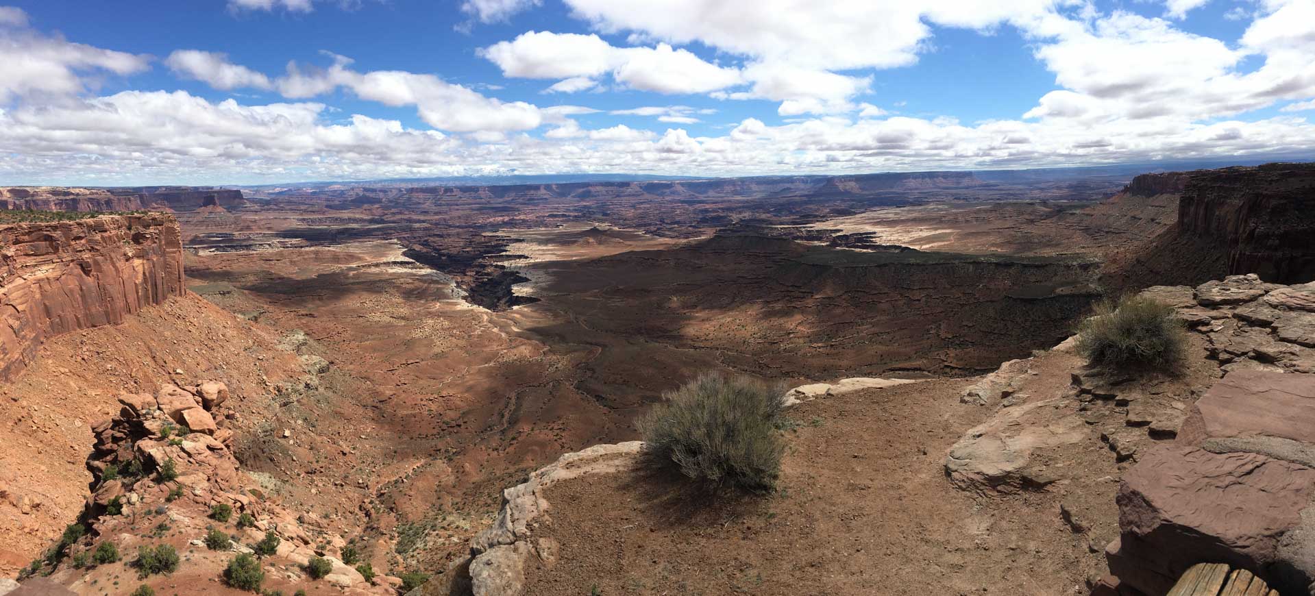
Canyonlands: Island in the Sky
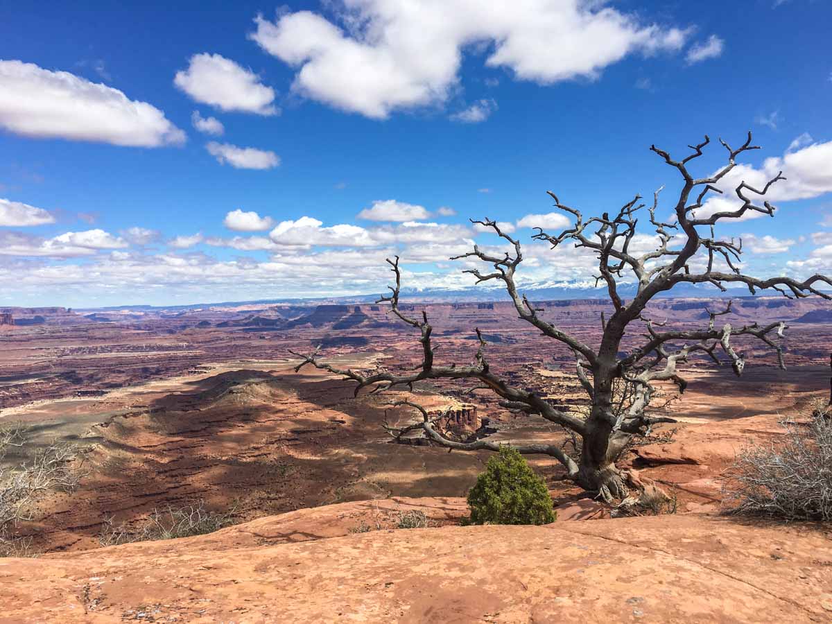
Island in the Sky is named so because it sits atop a large mesa 1000 feet above the canyon floor. In layman’s terms, you are on the rim of the canyon looking down. It’s really easy to navigate. You drive in one end, follow the scenic drive to the end and pull off at various spots to take in the view looking down into the canyon.
The Needles and the Maze are physically down inside the canyon, hence the remoteness, you have to drive for miles from Moab to go around the canyon walls to get down there.
Canyonlands National Park is actually really easy to explore. Having not done many national parks previously I did not know what to expect so I spent a lot of time researching how to plan a day out there. It turns out to be really easy. The National Parks Service gave us a map and an informative newspaper filled with helpful info including viewpoints, picnic spots and hiking trails so unless you need to decide on a long hike before arriving, there is actually little to plan for.
Big Mesa Viewpoint
Our first stop was actually before we entered the National Park. About 10 minutes after turning off the highway onto the 313 is a little pull out called Big Mesa Viewpoint. Since we were not on a schedule we took the liberty to stop wherever and whenever we wanted to. As a general rule, when I see mesas or buttes in the distance, I usually stop.
This was one such stop. As the canyon began to form in the windscreen, the first signs of something special were appearing and I was too excited to keep driving. It was a quick stop, long enough to take 10 photos or so then we were back in the RV.
Shafer Canyon Overlook
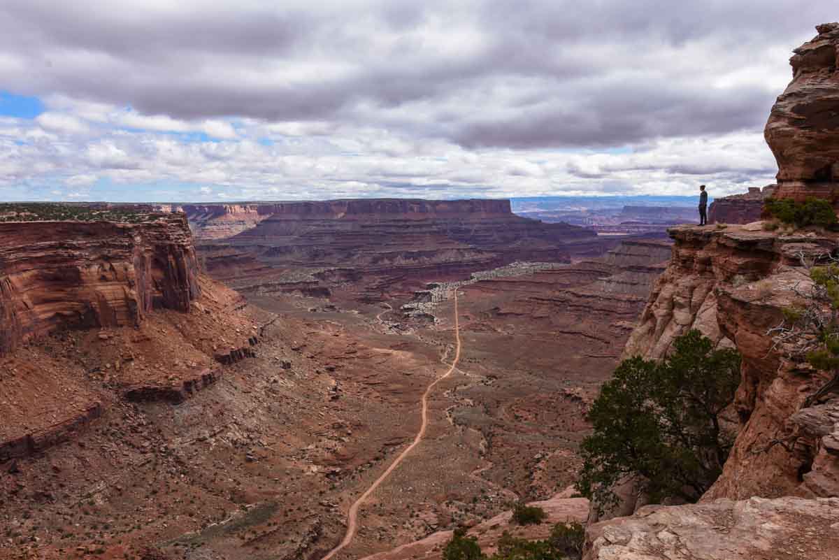
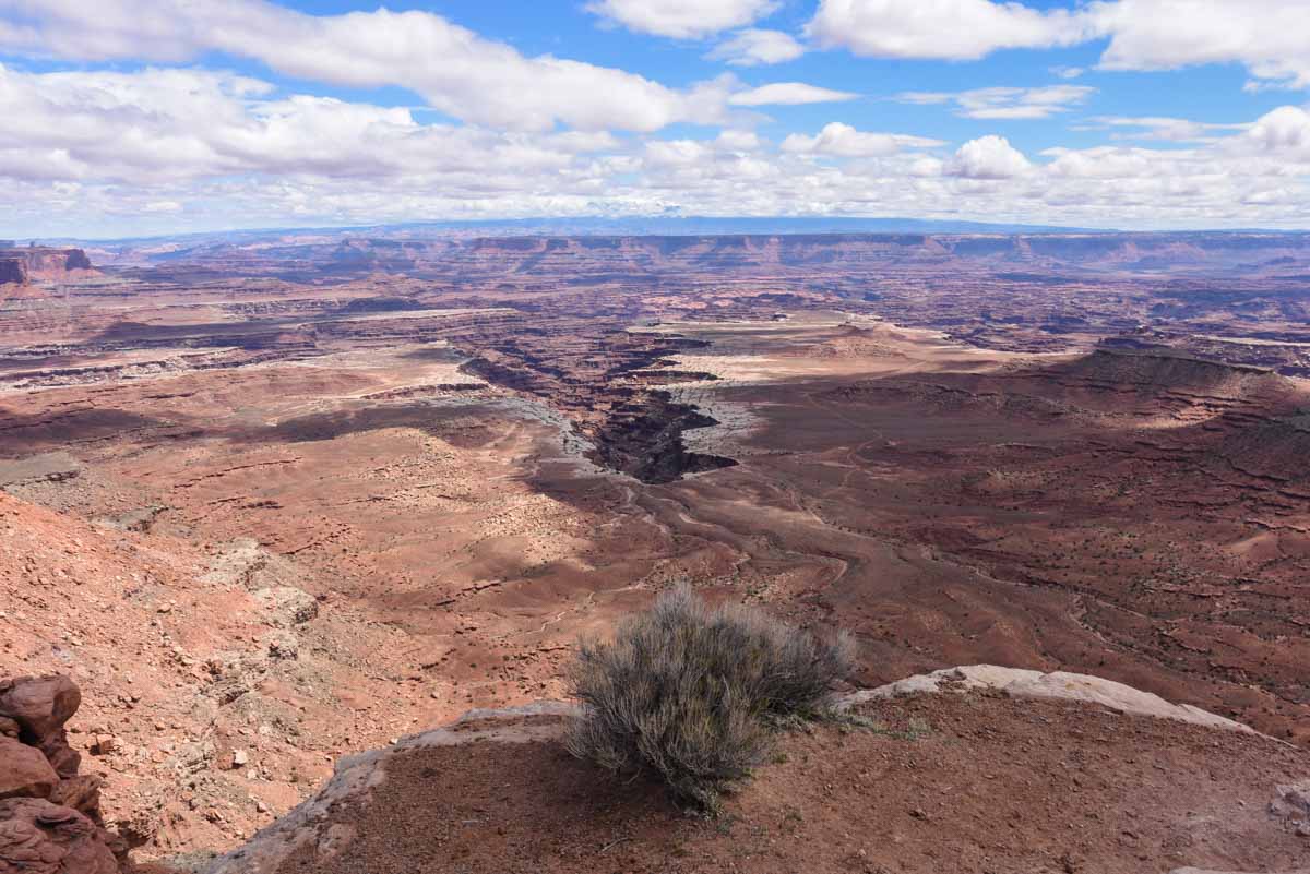
My initial plan was to drive to the end of the 17-mile scenic drive and slowly work our way back, but when I got to the first overlook, Shafer Canyon, I just couldn’t not stop, it felt almost rude.
So into the small parking lot we drove, parked and walked out onto the mesa top. This was our first taste of the unfathomable vastness of Canyonlands National Park. The canyon rim of Shafer Canyon reached out into the canyon allowing for a 270-degree vista.
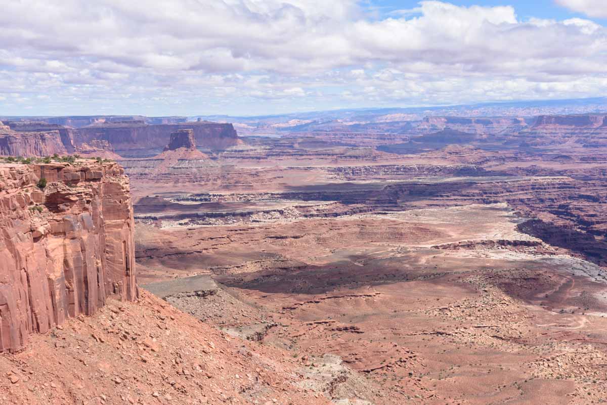
Candlestick Tower Overlook
About halfway down the scenic drive the road forks. Grand View Point Road goes to the south and Upheaval Dome Road to the west. Just past the fork is Candlestick Tower. The canyon into which you gaze is comparatively flat, but there is no mistaking the tall spire to the right from which the overlook got its name.
This was also the first section of canyon where I realised that there is actually a canyon inside the canyon. So down from where we are sitting on the rim, look further into the canyon and there is a lower rim that goes even deeper. Just astonishing.
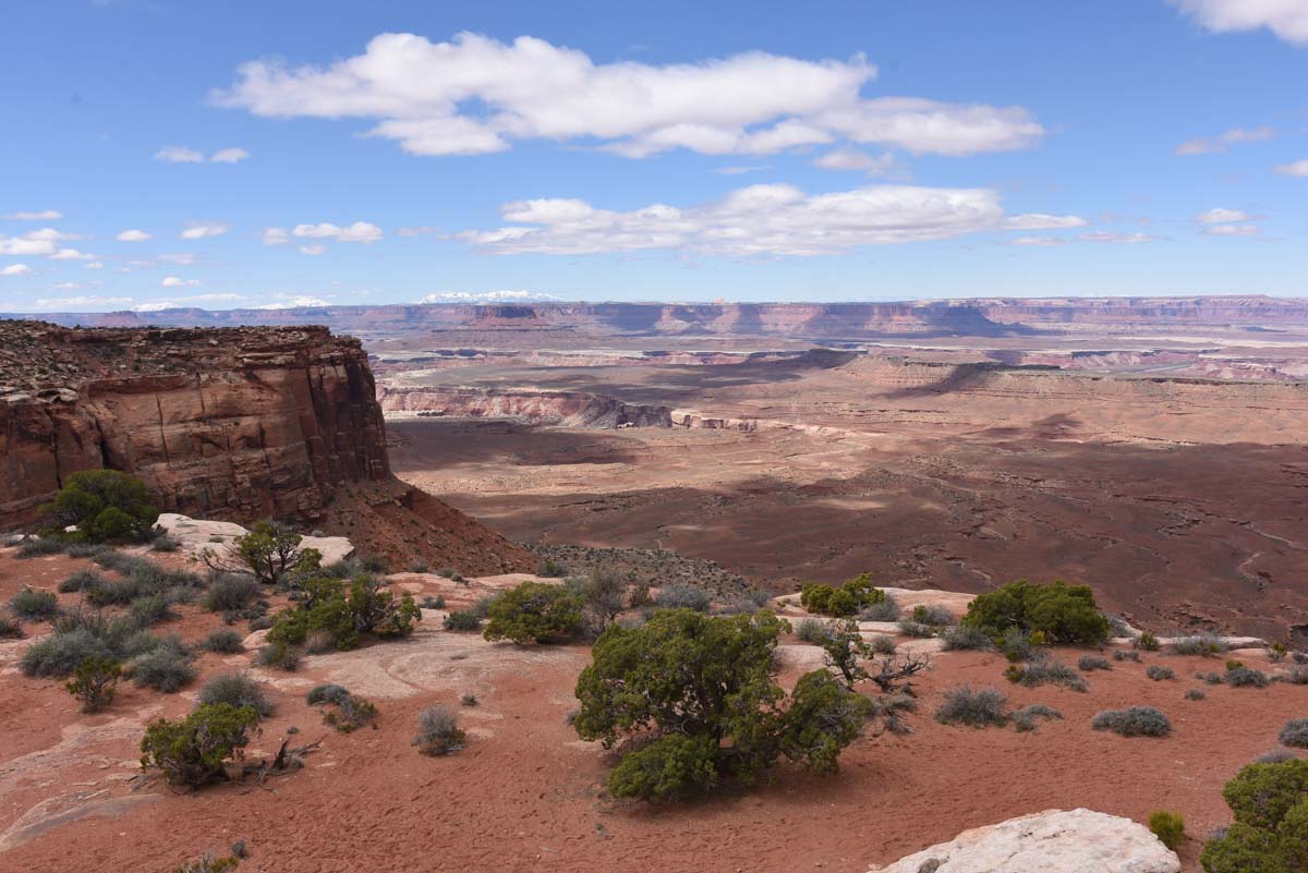
Buck Canyon Overlook
So the scenic drive cuts the canyon in two. You have the Green River to the west and the Colorado River to the east. Millions of years ago these rivers carved out this canyon with, presumably, a lot more water and wind than is running through it presently. The two rivers converge somewhere to the south of the canyon rim. You can see it on a map but not actually from the rim. While you’re in the Park, the rivers are less than an afterthought.
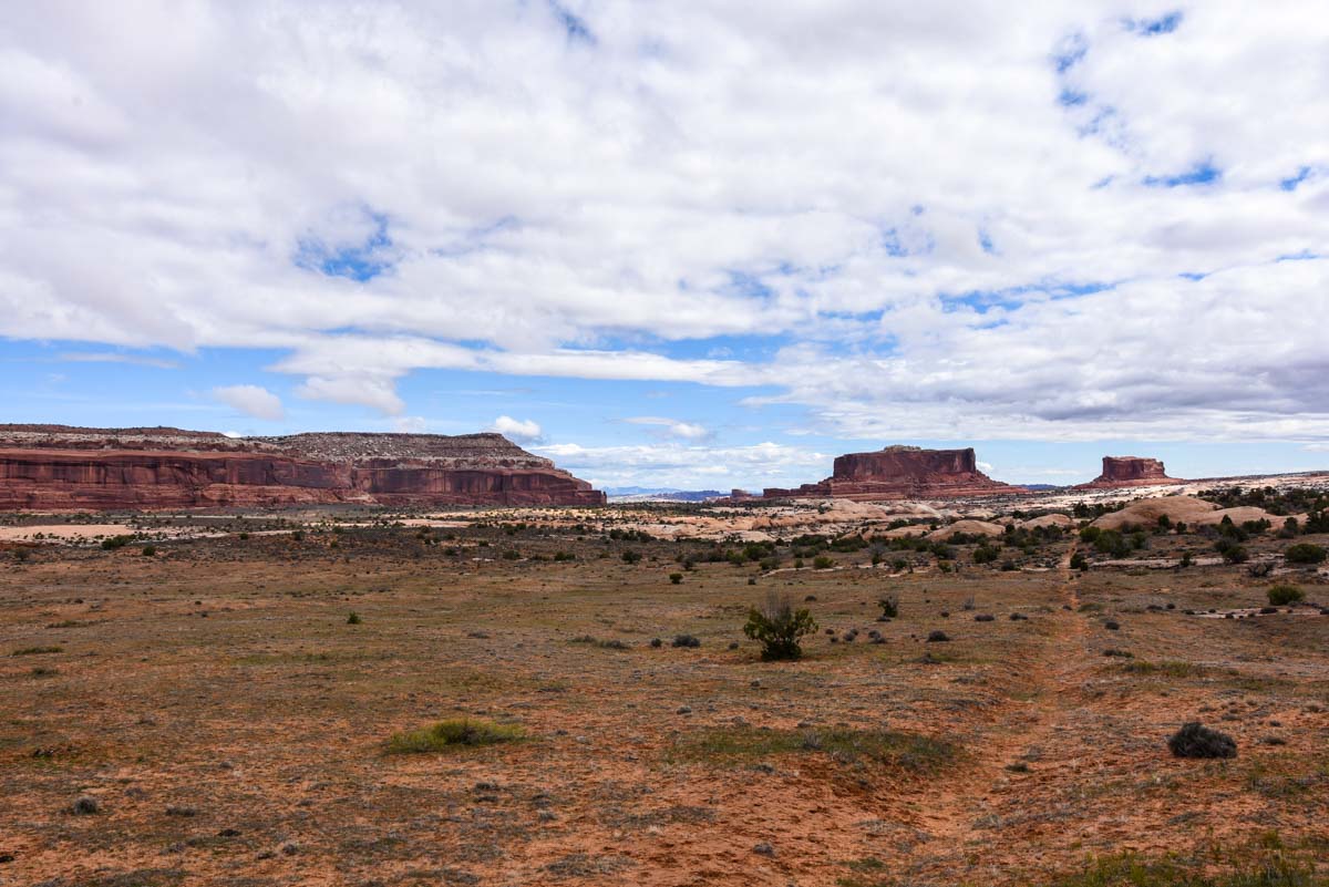
Buck Canyon was further on down the drive, this time looking to the left of the scenic drive towards the Colorado River. Exposed, high, red rock walls dominate the foreground while an array of sloped mesas and jagged cliffs fill out the middle distance. If you squint, you can pretend that you know where the Needles Overlook is on the opposite canyon wall.
Orange Cliffs Overlook
Someone very unimaginative has come up with this name. In a landscape completely filled with orange cliffs someone has singled out this one small area to be named after their appearance.
We’re back on the Green River (west) side now, which is the west. The western side just seems a little more vast than the vastness of the eastern side. The canyon floor is a lot flatter and the opposite canyon wall seems further away. One is not better than the other but it is interesting that they are somewhat different despite being next to each other.
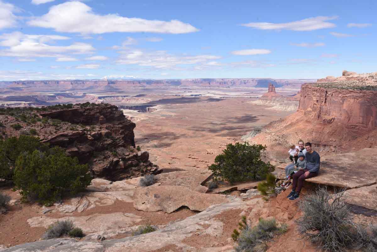
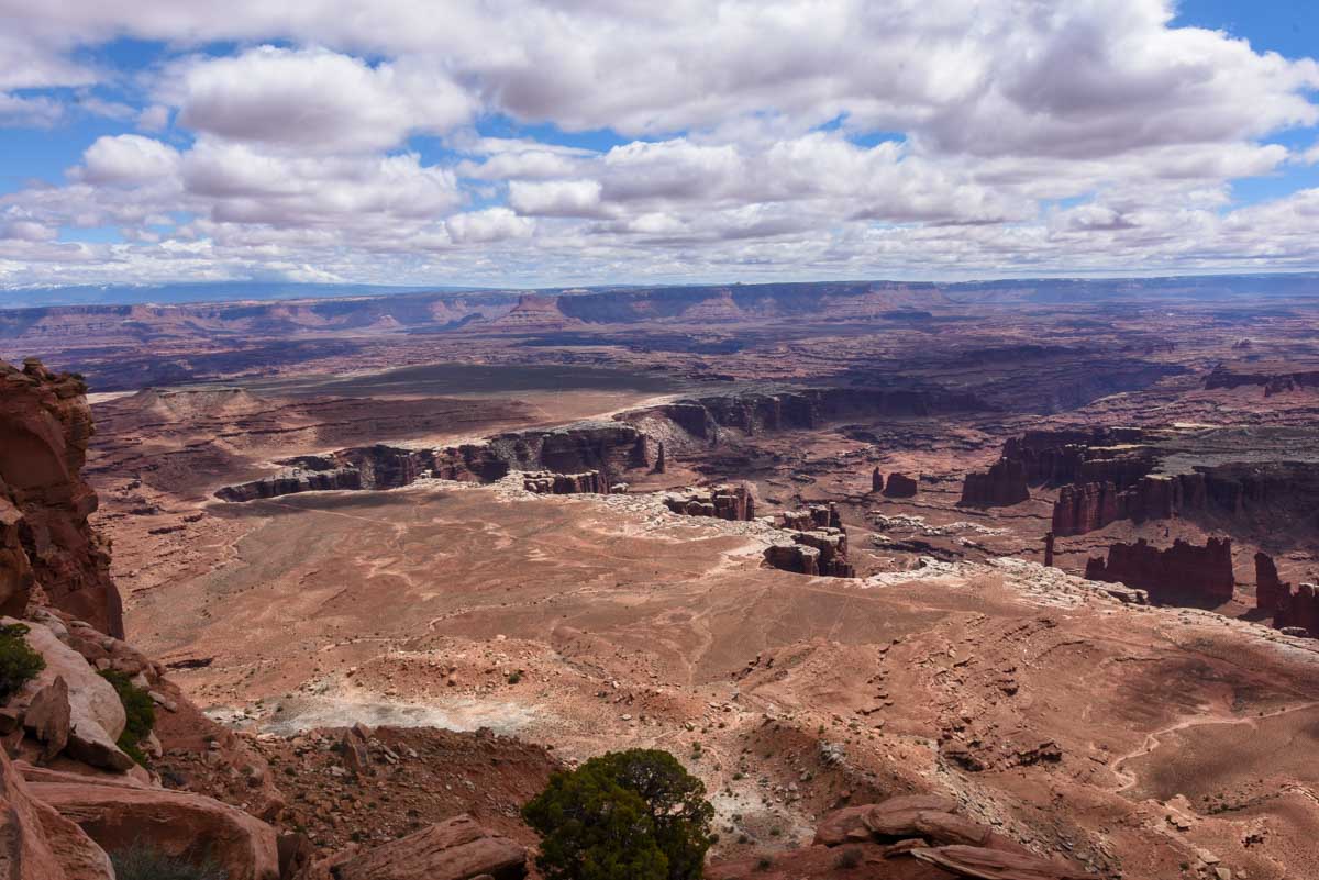
Grand View Point
I’m going to run out of ways to describe similar looking canyons soon and not long after that I’ll run out of superlatives. And if that’s going to anywhere it’s going to be at Grand View Point: the end of the line.
At Grand View Point there is a short walk out to an overlook that looks out over Needles to the southeast and The Maze to the southwest. You can’t tell where one begins and the other starts but it’s out there, you’ll just have to trust me.
All you can see is canyon upon canyon with delicate looking fins, gargantuan buttes and strangely, the odd dirt road from uranium mining trucks in the 1940s. Even though the road is not in use anymore, the aridness of the region — since it is a desert — has preserved the road and it will be years before the wind and the atmosphere wash it away.
There is a short walk that goes from the pathway out along the rim’s edge for about 500 metres. Kynie and Brooklyn almost gave me a heart attack by sitting on the ledge for a photo, which then had me on edge the whole time we were out there (kids can be so damn unpredictable!)
Thankfully none of us plunged to a bloody death over the side and made it back into the RV safely.
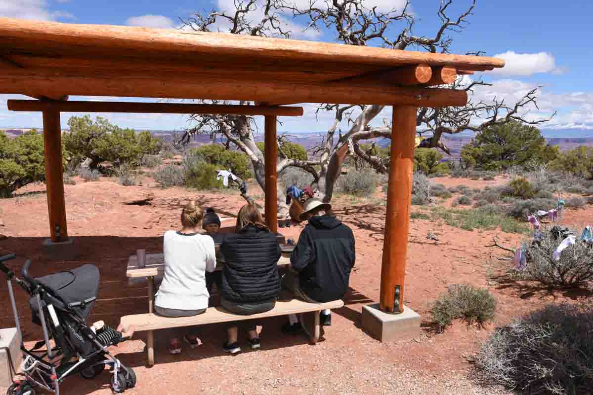
Lunch at the Picnic area
All this looking at red holes in the ground had given us an appetite and luckily, just back from the Grand View Point was a picnic area with one remaining spot. As opposed to a grassy park that might have a bunch of picnic tables setup close to each other, this picnic area was a rather large area with an array of covered picnic tables scattered around a loop, separated by trees and red sand affording a surprisingly high level of privacy at each picnic spot.
We backed the RV into the single available parking space and unloaded lunch with one eye on the horizon, as not 50 metres in front of us was another more personal view of the canyon’s edge.
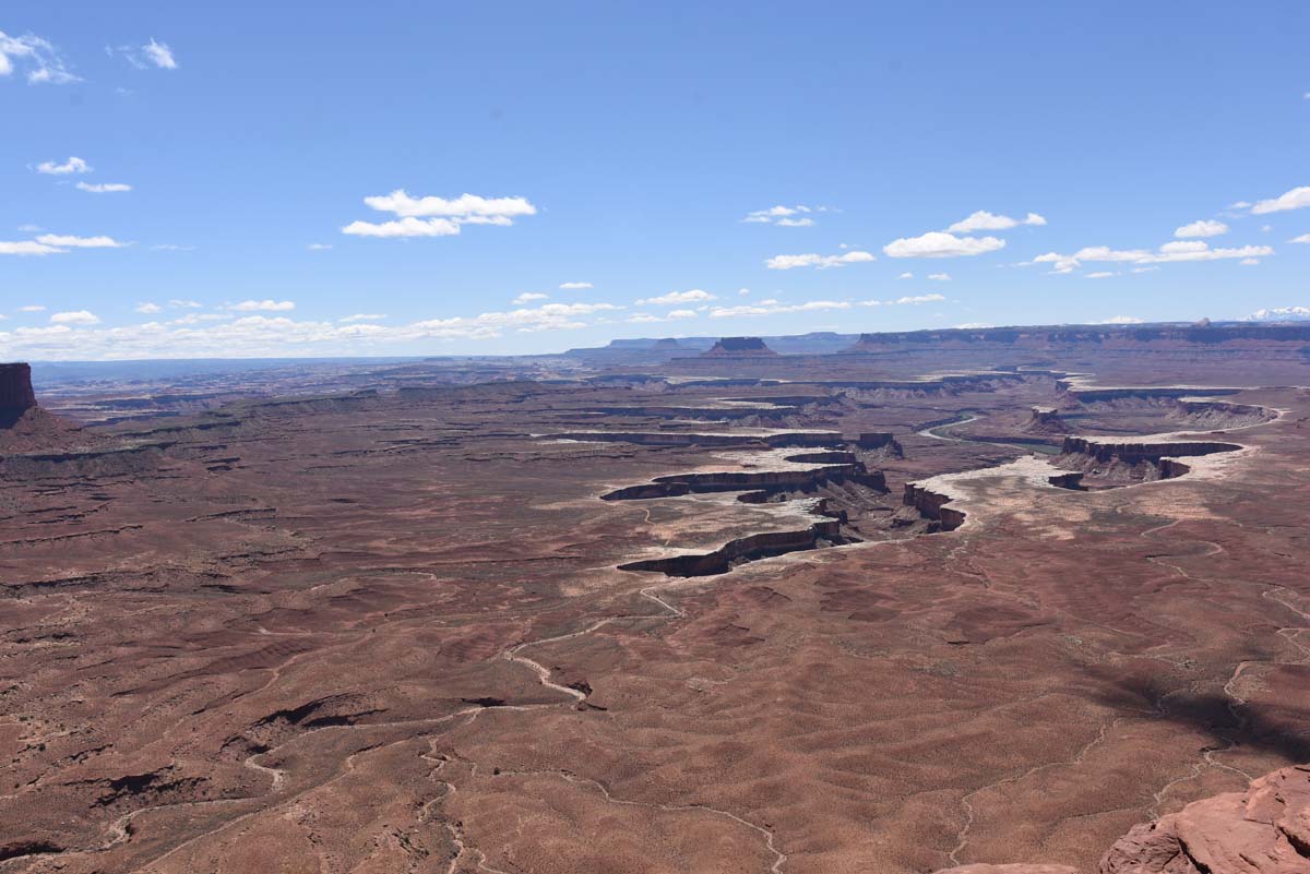
Green River Overlook
True to its name, and unlike the Colorado River on the opposite side, you can actually see the Green River from this vantage point. It snakes its way through the vast red rock plain on the lower level of the canyon floor.
They say that the river is the chief architect of places like this but since geology is not my strong point, I just can’t fathom exactly how this can happen. Sure, I concede that obviously, the land here looked very different 300 million years ago and a lot has happened in this time but still, the river seems so placid compared to the gargantuan craters it has supposedly created.
I suppose I will just take the experts at their word and enjoy the view.
Whale Rock
Near the end of Upheaval Dome Road is Whale Rock, a large sandstone dome that, when looked at from a particular angle, looks somewhat like a humpback whale. As with most things that are named for their shape, some imagination is required, but not much.
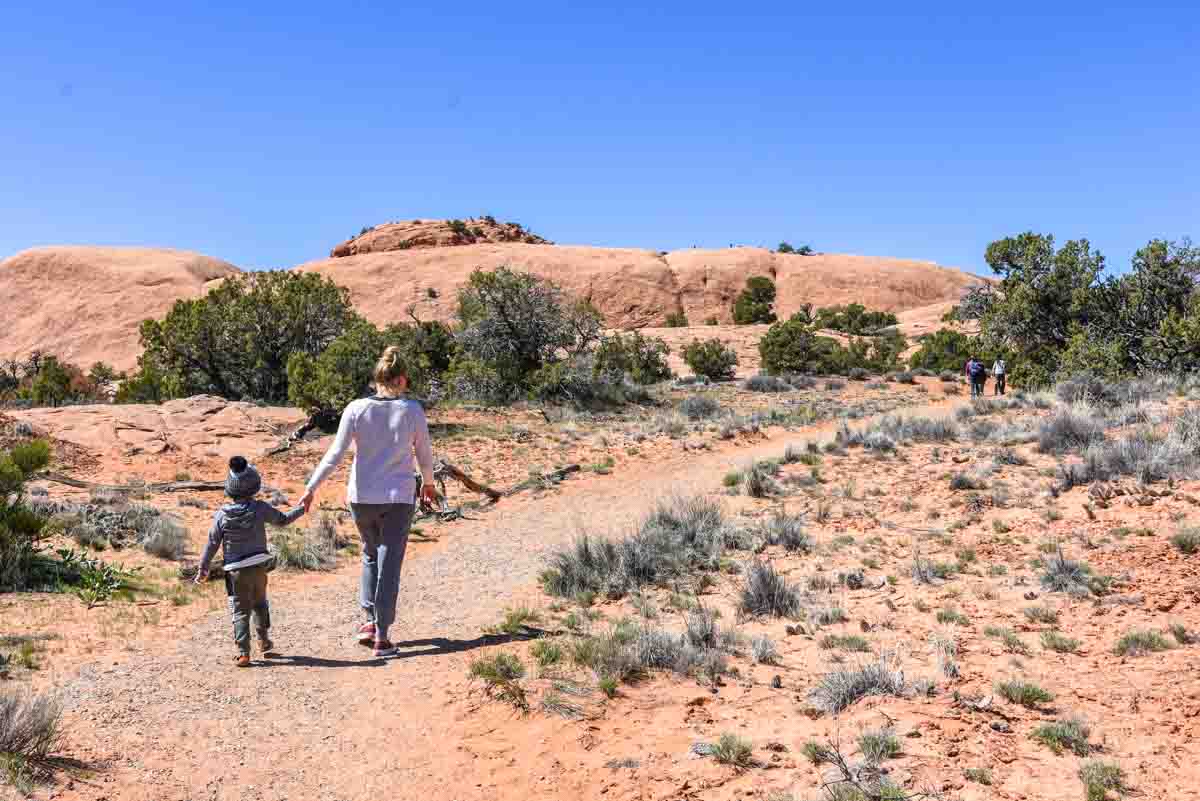
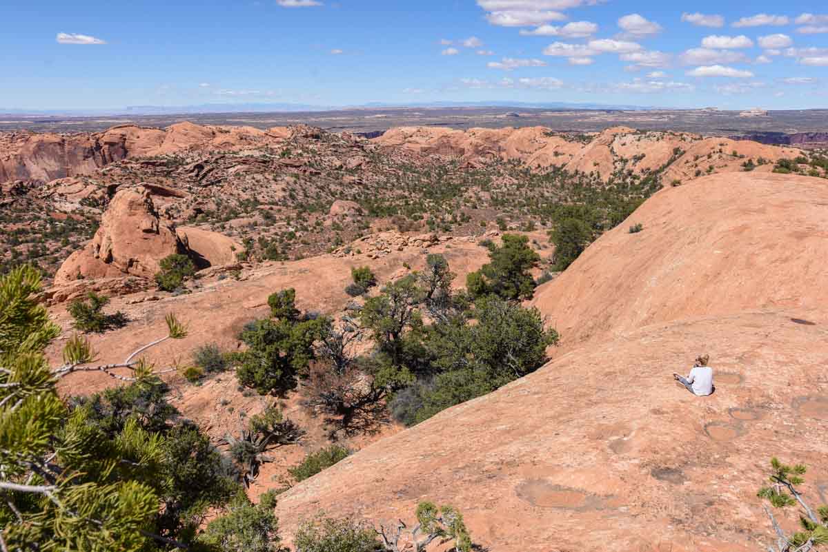
Since the rock was pretty close we set out to climb on it without much thought. The path began as gravel but shortly we were walking on the sandstone, ascending the rock. The sides of the rock are actually quite deceiving. From the bottom, much of it looks walkable, but it is not until you are halfway up that you realise it is getting close to vertical so if you fall, it’s going to hurt. A lot. Given that Brooklyn was with us we weren’t too keen to do many of these so we took the slightly longer but easier path, (which also happens to be the recommended route).
It actually took about 40 minutes to climb to the top of Whale Rock from the parking lot, which is about double what I expected. It definitely is further than it looks. From the top you look down back down on the road surrounded by red rocks in every direction. National Parks rates it as a moderate hike but anyone who is fairly mobile (even a 3 year old) will make it up without too much effort.
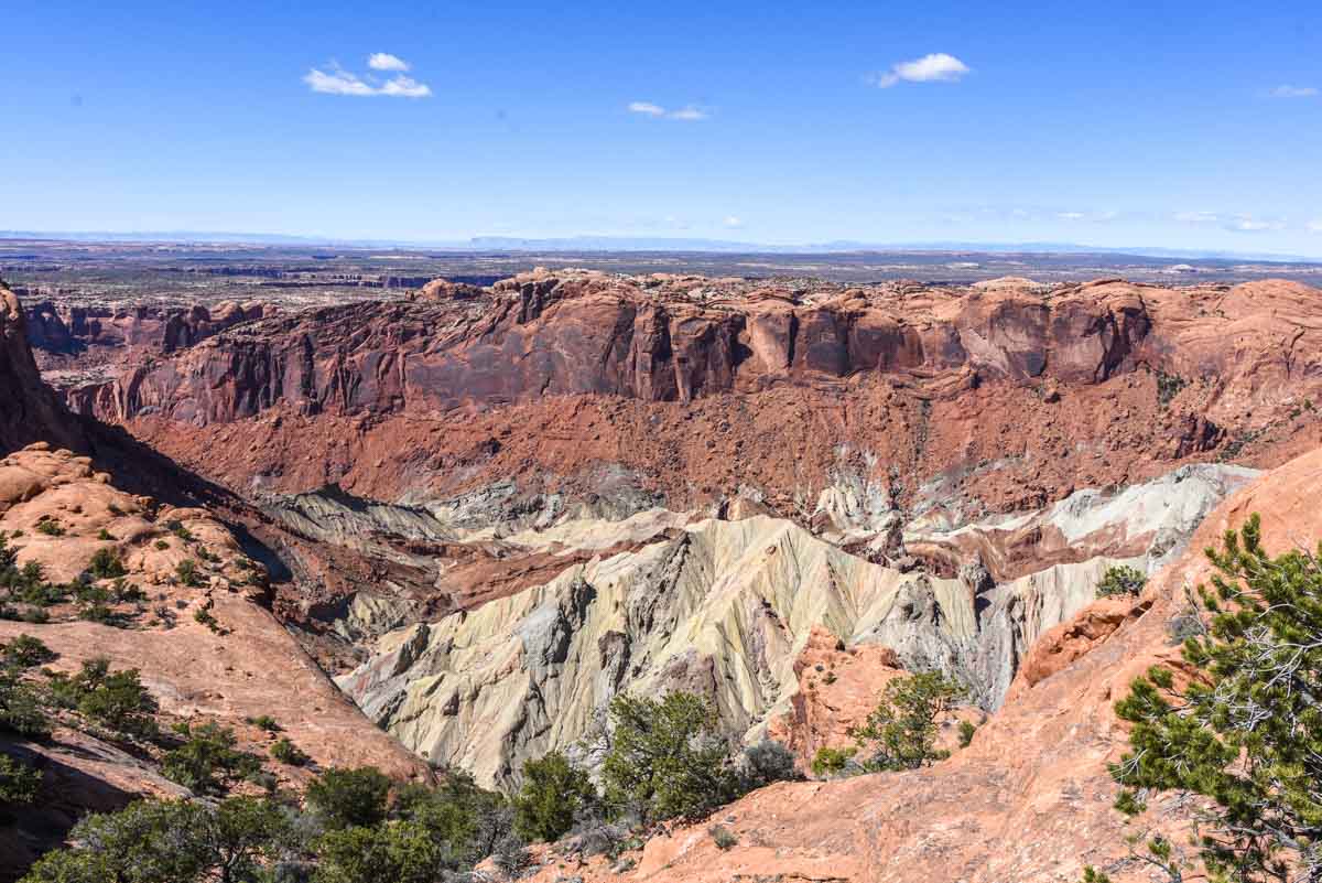
Upheaval Dome
Upheaval Dome was the last stop for us. At the end of the road, a steep 15 minute walk will bring you to what looks like a crater, into which you’ll peer down to some rare white stone that literally looks like it’s been heaved up out of the earth with a tremendous force. Geologists are still not quite sure what caused this dome but there are 2 hypotheses. I am not going to try to explain them but you can read about it on the NPS website.
We did not walk to the second viewpoint as we felt we could see it clearly enough where we were. Going to the second viewpoint will add another mile to the walk, taking it to 1.8 in total.
We jumped back in the campervan and began the magnificent drive back out of Island in the Sky to Archview RV park, where celebratory beers on a job well done were enjoyed.