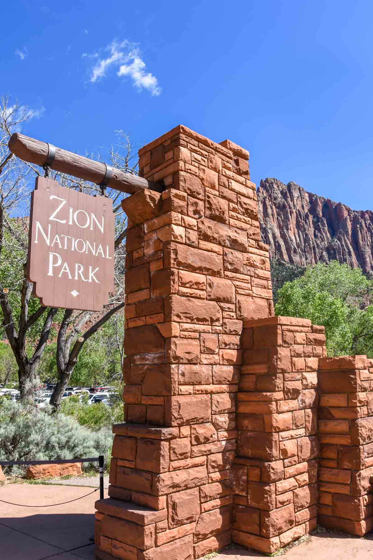
Zion Canyon is one of Utah’s many natural wonders and it is easy to see why over 4 million people visit each year. I had been wanting to visit Utah for a good many years and despite previously visiting the USA three times since 2014 I could never spare enough time to do it justice.
This time around, we made the time to visit some of Utah’s best National Parks and with 2 days in Zion Canyon, I had enough time to be simply awestruck by the natural beauty of the sheer stone walls that surround you from the moment you enter the park.
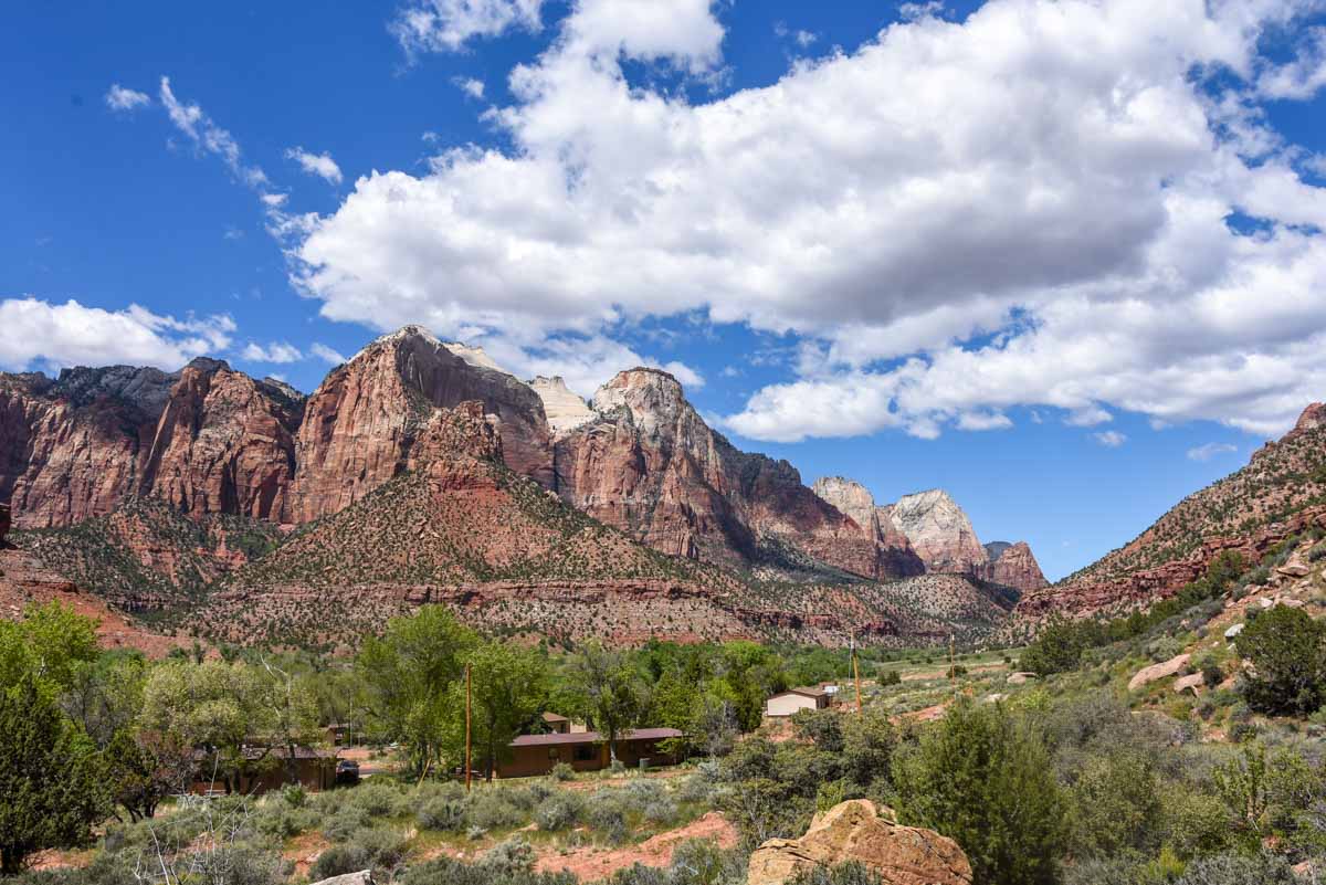
Orientation to Zion Canyon
What’s great about Zion is that you don’t need to be super active to be able to enjoy the park’s splendour. Zion has hikes appropriate for all levels of fitness, some of which can even accommodate strollers and wheelchairs (some better than others).
The easier hikes generally led a short way up the hill to give a nice view up at the other side of the canyon, or lead to the base of the canyon among trees.
Moderate hikes might follow a trail up and around one of the canyon mounts but probably won’t get you to the rim.
The difficult hikes generally lead you up to the canyon rim and are therefore quite steep. I’ll go through my experiences below.
Zion is fed by the little town of Springdale. The town exists solely to service the National Park so there are plenty of amenities like accommodation, restaurants and some shops. You can even hire hiking gear (particularly for the Narrows hike) at a shop near the visitor centre.
Click here to search for accommodation around Zion Canyon. And here’s a tip if it’s not inside the park or Springdale, you won’t be super close.
We visited Zion in April, which felt to me like the best time of year to visit Zion, as it was warm, but not ridiculous, and the crowds weren’t insane like it might be in peak summer.
Getting around Springdale and Zion Canyon
Zion Canyon has one road that spans the canyon from the visitor centre and canyon entrance down to where the canyon narrows. In the peak summer season, this road is closed to traffic and reserved for use solely by the Zion Canyon shuttle. The shuttle a great service that drops off visitors at 9 stops along the scenic drive from the visitor centre. It runs from about 7am to 8pm so there is plenty of time in the day to spend exploring. The buses come every 10-15 minutes and is a really convenient way to explore.
There is also the Springdale Shuttle, which connects visitors from the visitor centre to various places throughout Springdale. Since you have to go through Springdale to get to Zion, it’s a one way in/one way out kind of deal. The length of the town shuttle is quite long so if you’re staying nearby, there’s a good chance you’ll be on the route. Parking is quite limited around the park and the visitor centre so I suggest you take advantage of the Town Shuttle where possible.
For more information on how to use the shuttles, please see the National Parks website.
Our Adventure in Zion, Day 1
It was a slow morning out of Bryce Canyon, where the day began. Pancakes were on the RV menu so that was good enough to set a departure time of 9:30.
Late? Perhaps. Leisurely? Most certainly. When you do back to back adventure days sometimes the best thing is to take it a bit slower every now and then so you don’t go insane.
Since the Carmel Scenic Byway was closed for repairs at this time, we had to take the long way around via route 14, doubling the time to get there. By the time all parties were present and accounted for in Zion, it was 2pm, leaving us still a maximum of 6 hours in the park.
Before arriving, for some reason I just couldn’t work out in my head how Zion works. I knew you had to take the shuttle but I still wanted to talk to a ranger. The rangers are always helpful and they gave me some ideas on how we could fill in our afternoon. We jumped on the shuttle, bound for stop 7.
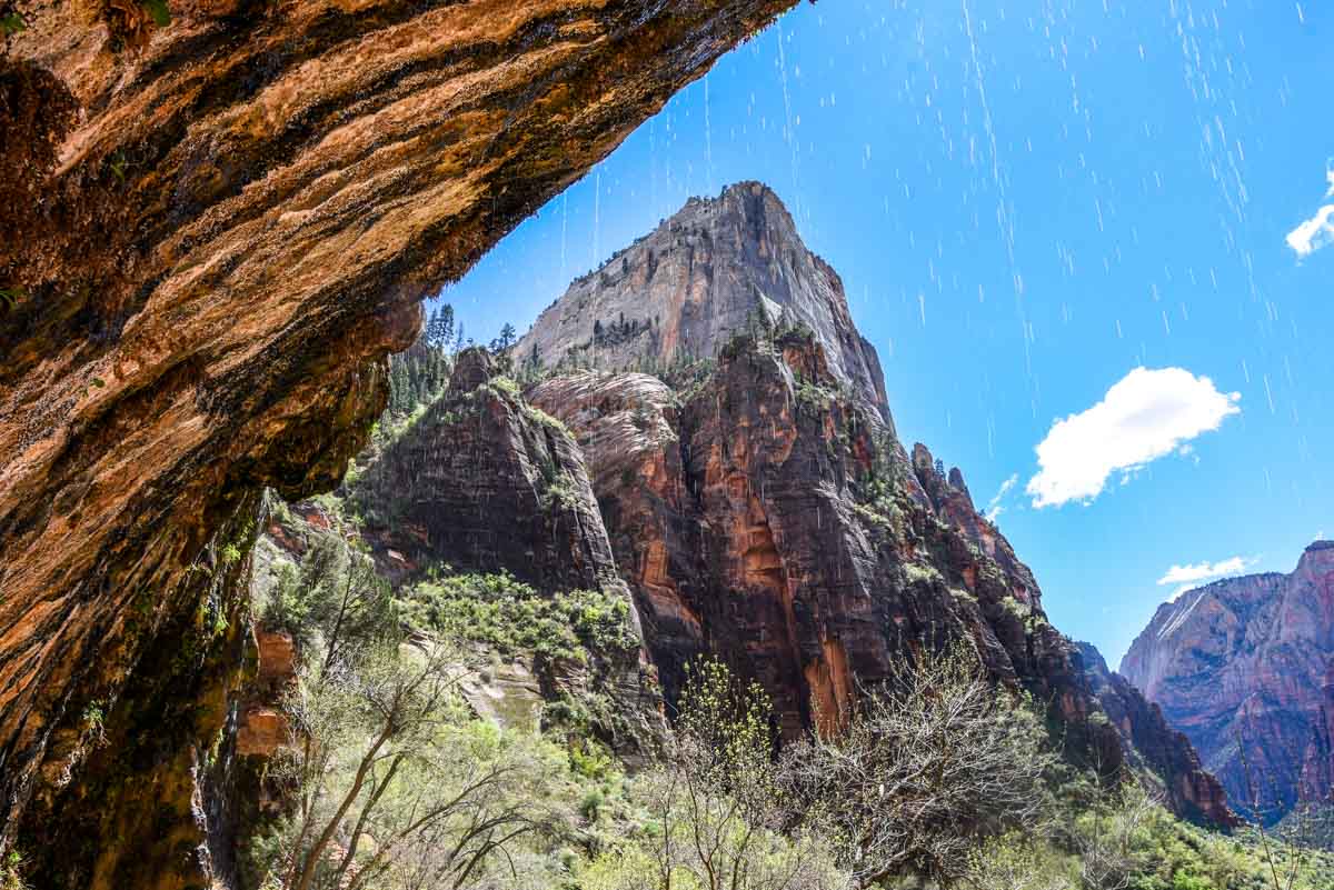
Weeping Rock
The Weeping Rock was a very short walk up a very steep incline. Even though it was paved, we began to regret bringing the stroller fairly quickly. It was doable but hard work. After 400 meters of nothing but uphill we arrived at a large rock alcove over which spring water continually dripped.
More impressively though, it gave a great view out over the valley for a pretty short walk.
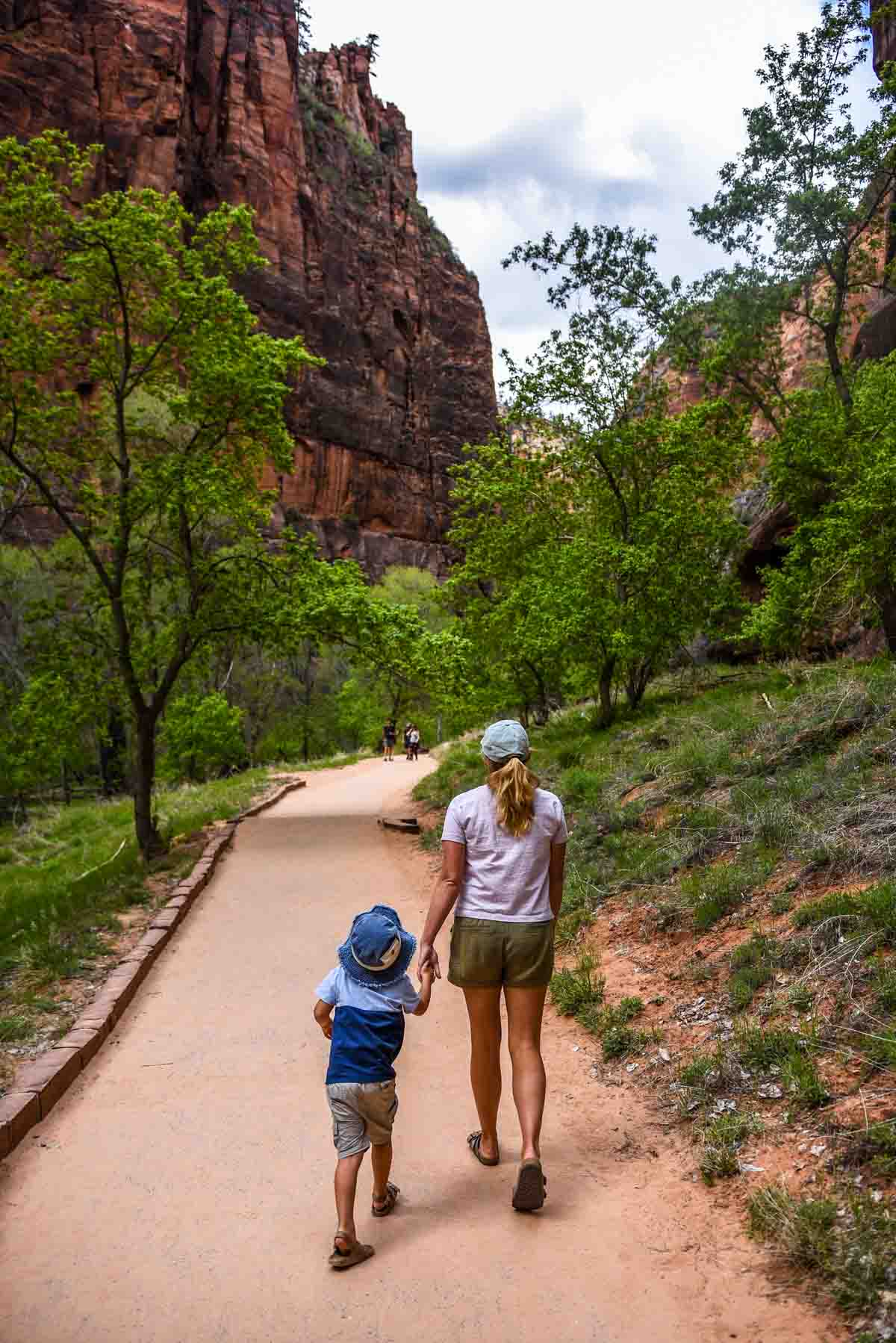
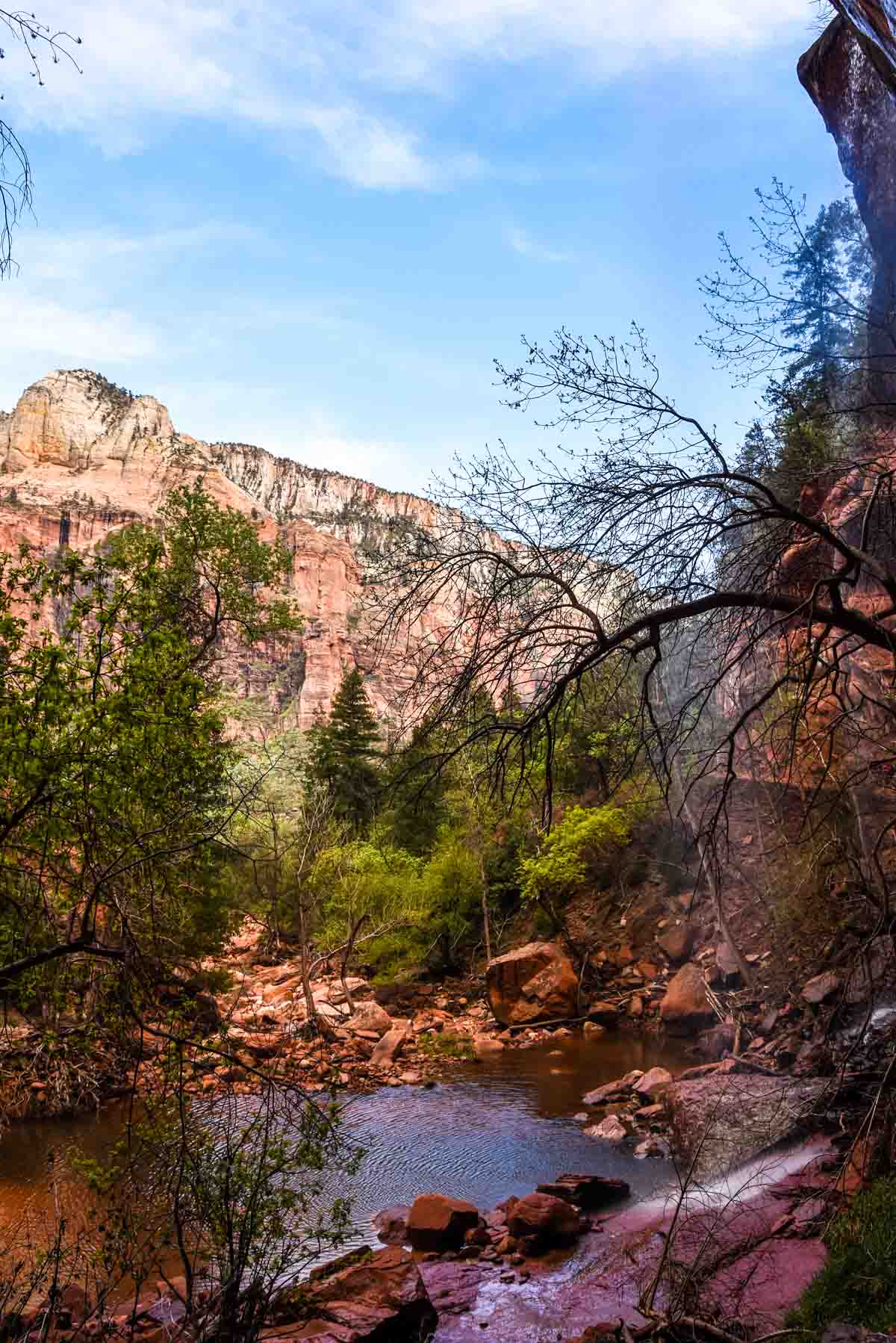
Riverside Walk
Stop 9, called the Temple of Sinawava, is the end of the line. From here there is one trail called Riverside Walk. The riverside walk is an out and back paved trail that follows the Virgin River through Zion Canyon.
It may sound pretty dull but the trick here is don’t look down at the river, look up. You are surrounded by towering red stone cliffs that reach to the sky. It’s a beautiful walk and a great way to wander through the park at a leisurely pace.
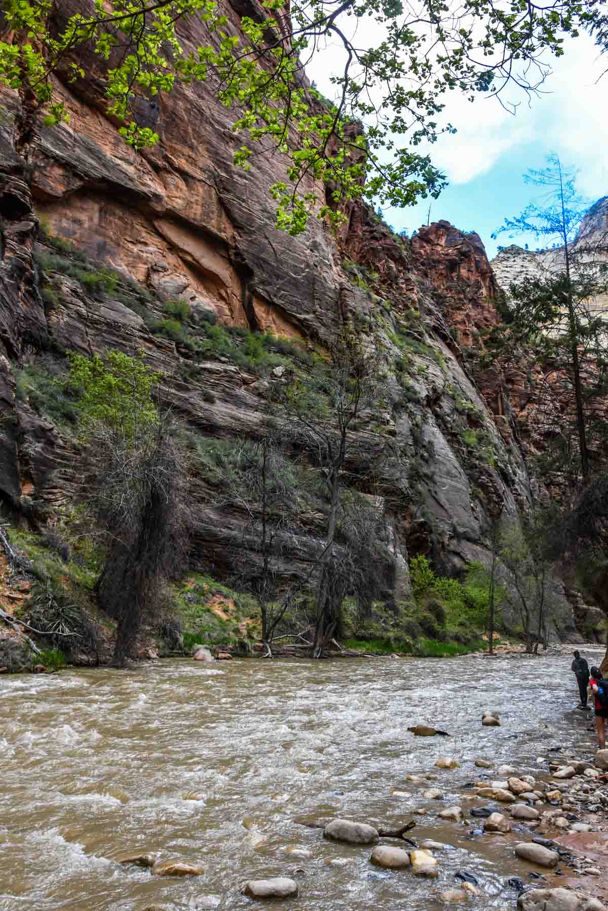
At the end of the riverside walk is also the beginning of the “bottom up” Narrows hike. We didn’t do this because it was closed (among other reasons). The hike is closed every spring due to snowmelt, which causes a surge of flowing river water.
The Narrows essentially follows the Virgin river further through the canyon but instead of walking beside it, you walk through it. Since the hike is quite literally walking upstream in a river, due to snowmelt in spring, the river was raging at a pretty decent pace; not a fun way to hike. The Riverside Walk took about an hour and a half.
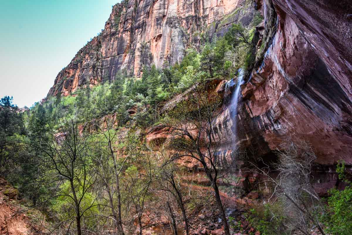
Emerald Pools Walk
We returned to the shuttle, which was then making its way back toward the visitor centre and this time we got off at stop 5 for the Emerald Pools Walk. This paved path takes you towards the canyon wall through what would otherwise be pretty dense scrub to another much larger rock alcove. It was a pretty similar concept to the weeping rock actually, but more water and more rock and twice the length to get there.
The walk was pretty flat and very easy. If you are able to walk for an hour, you’ll do just fine. The walk gave some great vantage points of the rocks on the opposite side of the canyon too which is a nice bonus.
As an aside, I met some nice girls from New York on the trail after swapping photos. When I said I’m from Australia they came back with probably the two most common responses which were “Australia has a lot of deadly animals hey” and “I really like your accent”.
After these walks it was 6:30 and definitely time to call it a day. The canyon shuttle took us back to the visitor centre and the town shuttle took us to the RV park.
It’s a great system that seemed to be working like clockwork. We hardly waited at all for a shuttle and because cars are banned, there’s no traffic or congestion and no need to worry about parking at each stop.
Hiking up to the Zion Canyon Rim, Day 2
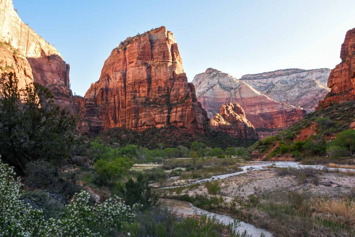
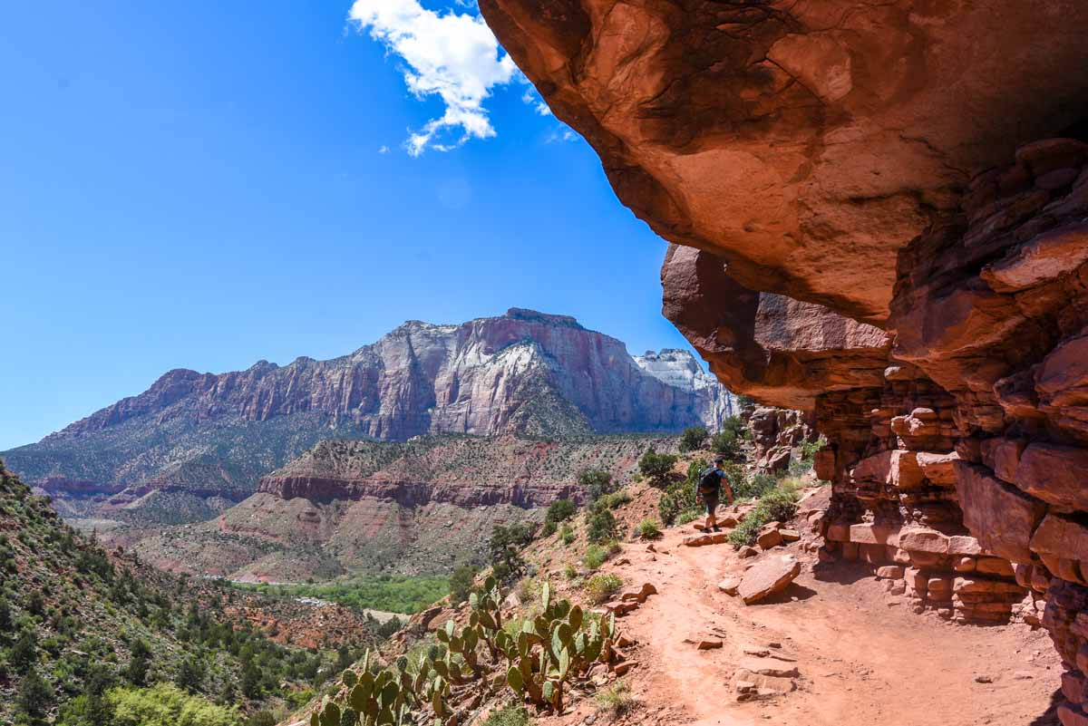
On our second day in Zion I got an early start to beat the crowds and beat the heat. Harv came with me to venture up the West Rim Trail to Angels Landing. Angel’s Landing was actually the only rim trail that was open as the other trails maintained by the NPS had been damaged by recent storms (the same storms that damaged the Carmel Tunnel).
We crossed the Virgin River and the path became sandy but only for a short time. The path weaves along towards the cliffs much like Emerald Pool Trail did yesterday but instead of stopping at the base, we ascended the cliff face on a series of ingenious paved trails.
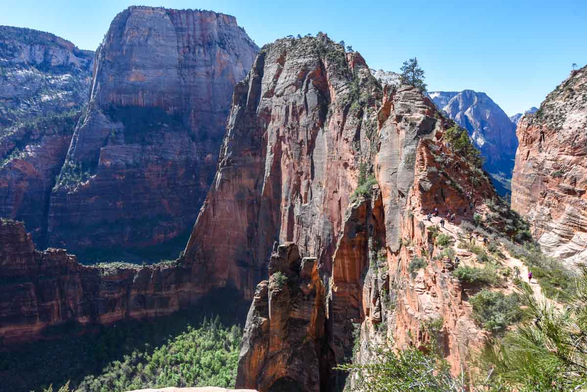
Before long the switchbacks began. From here, Angel’s Landing is pretty well straight up. You get an awesome view of the peak from the trail so you know exactly where you are headed. Without the well-built paths you’d literally have to rock climb so when we got to the base of the canyon wall it got steep. Real steep.
Unlike many trails, the trail up to Angels Landing was also paved pretty well the entire way up. Presumably this is because it receives such heavy foot traffic that any other path would not be sustainable.
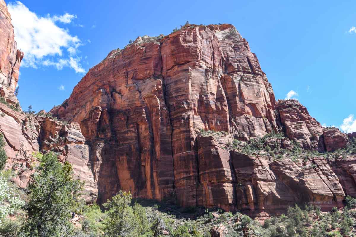
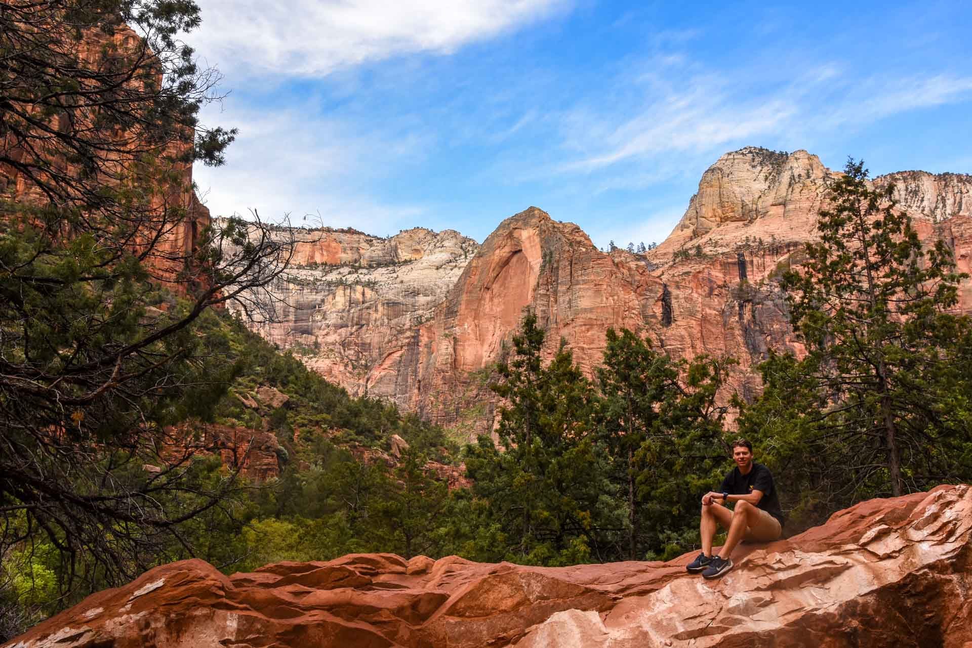
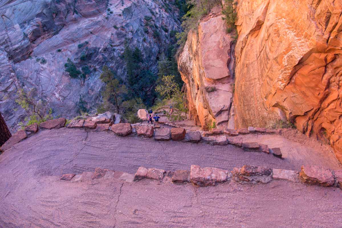
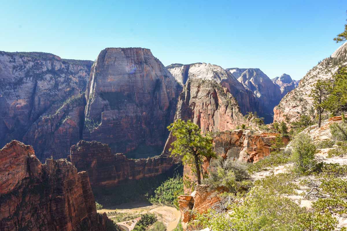
Up the cliff wall we walked. Being early, traffic was largely one way, with only a few hardcores walking down already. The whole way up I was just in awe of the feat of sheer human will to actually build his path. You can’t see it well in the image above, but the short cliff in the left of the image is where we are immediately headed, from which is the below photo is taken.
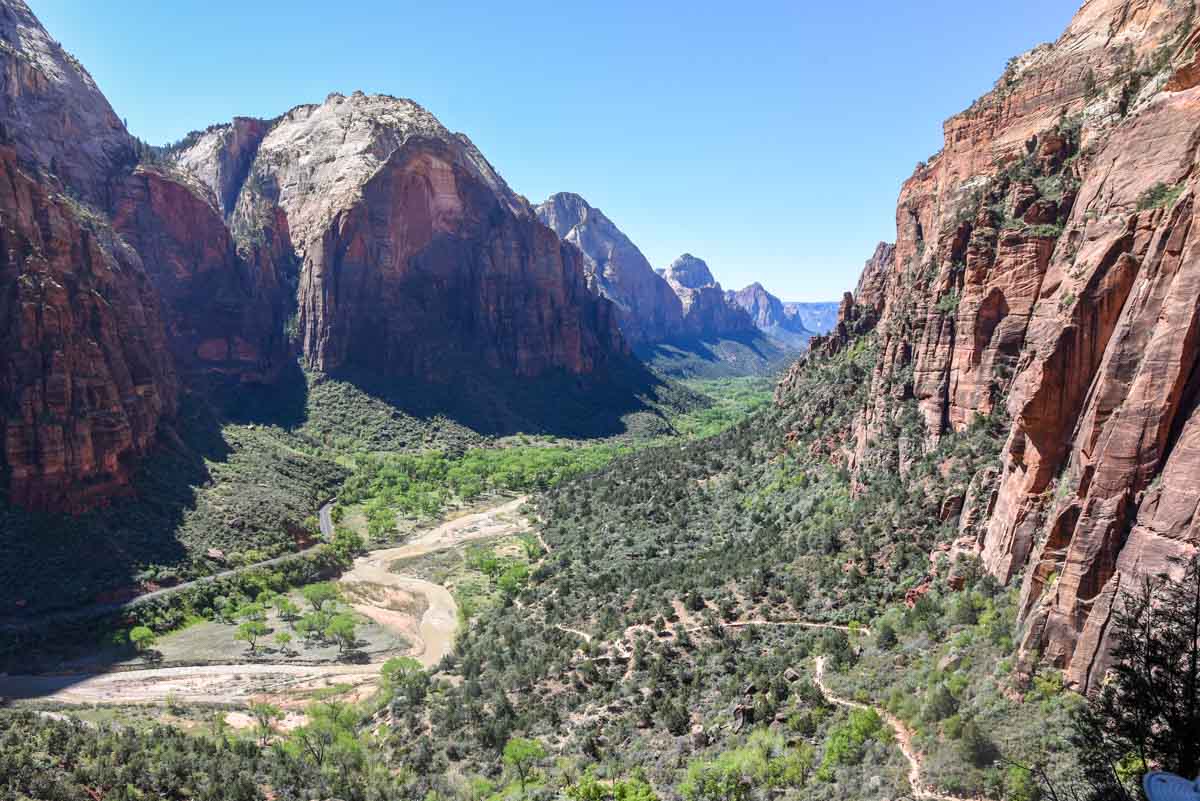
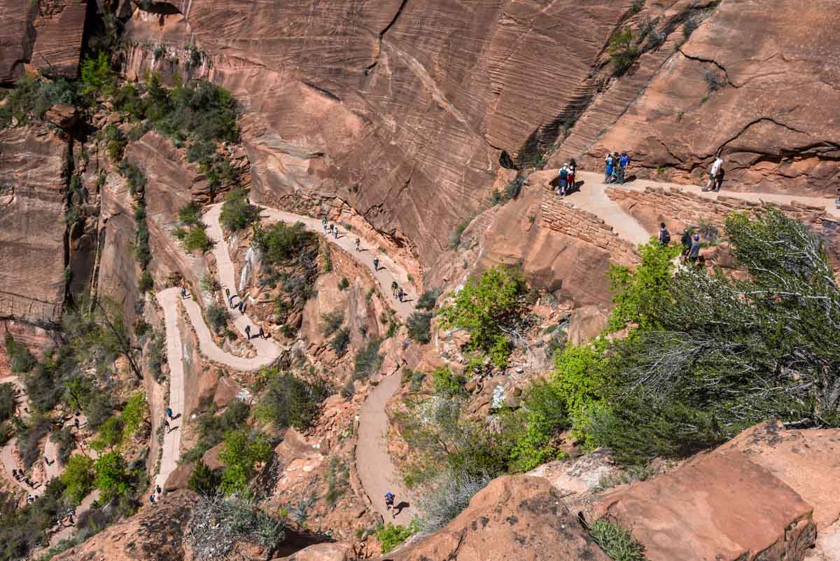
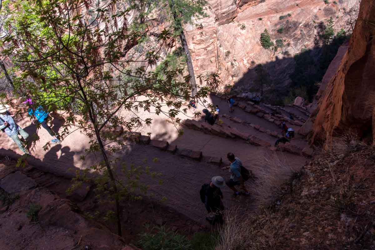
The path wound up and up, each turn giving a slightly better view of the canyon below. Some vantage points highlight the marvel that the trail is, winding this way and that, reinforced by tonnes of retaining wall, humans winding back and forth along some kind of maze.
Walter’s Wiggles
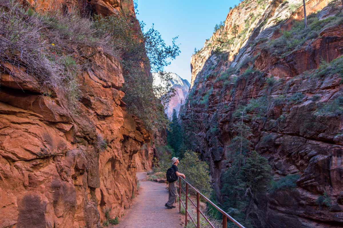
After the first set of switchbacks we reached what can only be described as a large crevice between two of the canyon peaks. It was shady and as it was flat, and it provided a reprieve. The crevice took us what felt like through the canyon wall and we would then walk back up and over to the edge to where the angels landing trail begins.
But to get there we had to ascend Walters Wiggles; a series of 21 short and steep switchbacks leading to Scout’s Lookout. Each pair of switchbacks ascended maybe 4-5 meters; it was virtually a vertical climb, made possible by some clever engineering from Walter Reusch, the first supernintendo of the National Park.
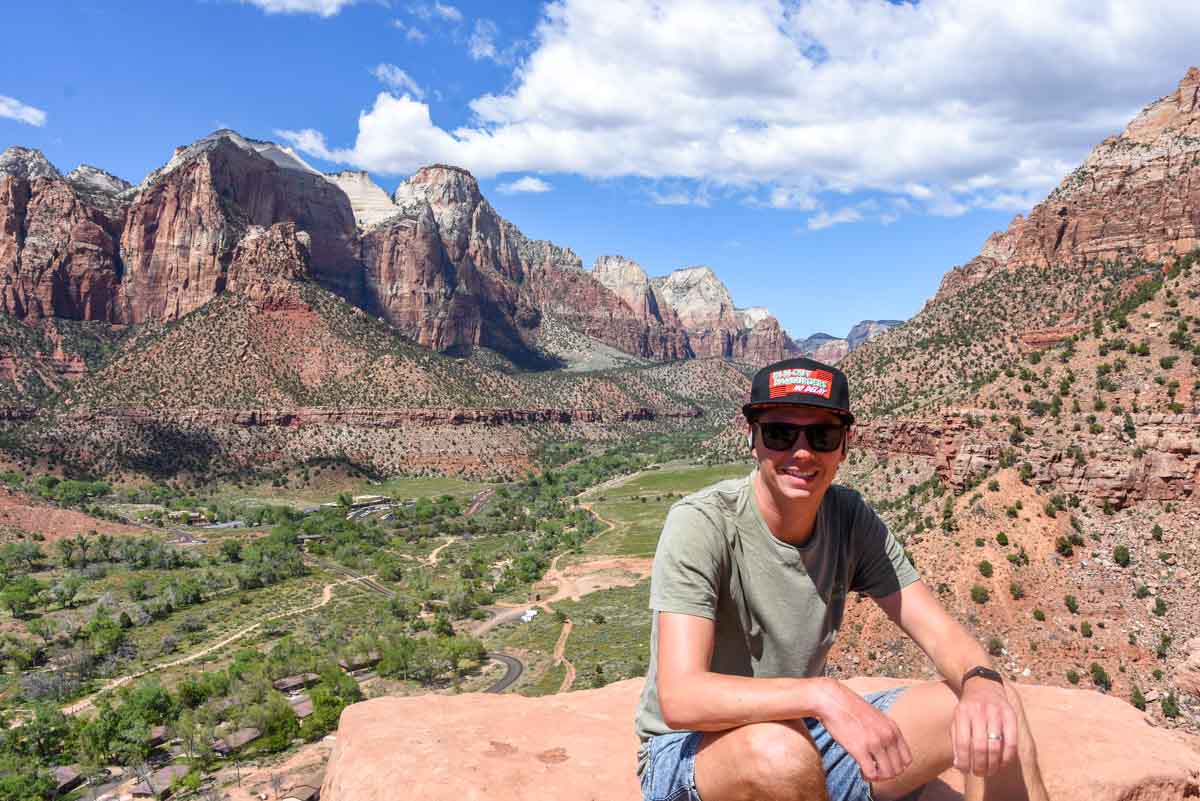
Scout’s Lookout
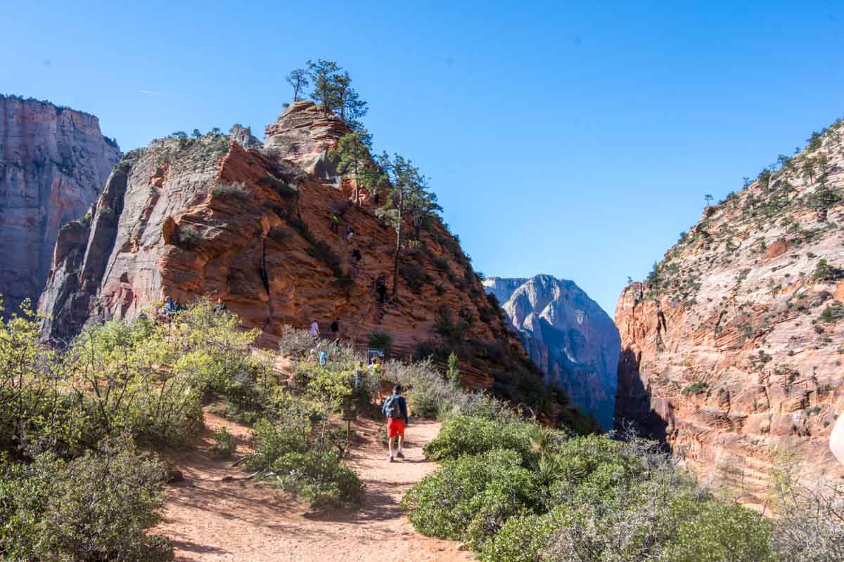
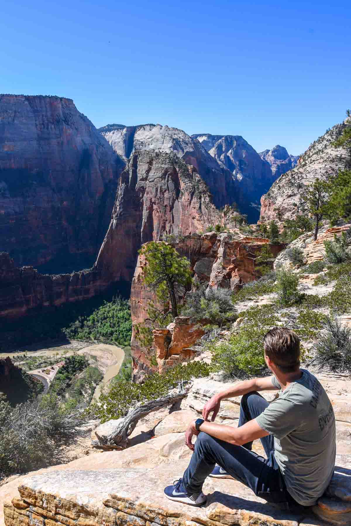
After Walter’s Wiggles we were almost there. It was a short, easy cruise across some large, flat rocks and sand to get to Scouts Lookout which gave a great look down north to the virgin river and the road leading deeper into the canyon. It wasn’t the spectacular view that angels landing provides (I assume) mainly because the bit of rock that is angels landing is kind of in the way.
This was a perfect spot for a snack and consider my options:
Option 1: turn around and head back down
Option 2: risk death for an incredible view straight down Zion Canyon.
While I considered these, Harv went exploring up Angel’s Landing to see what he could see. I mentioned that Angel’s Landing was the only trail up to the rim open which only seemed to exacerbate what is already a very busy piece of real estate. The stream of people, despite still being early was constant, and in parts, the “trail” up the rock face is only one-way — despite two lanes of traffic needing to get by.
While I enjoyed the view, I actually came up with a third option:
Option 3: continue following the Rim Trail north.
I didn’t know where the trail led and since we had time on our side we decided to find out. After about 5 minutes I asked someone how far it went and they responded “about 42 miles”, as they had just walked — over the last 3 days — from Kolob Canyon, the other section of Zion National Park.
Eyes wide at their achievement, we continued wandering — not for 42 miles, but maybe about 10 minutes. Once on the rim, the trail is not difficult and we took up a seat just off the path to take in the view some more.
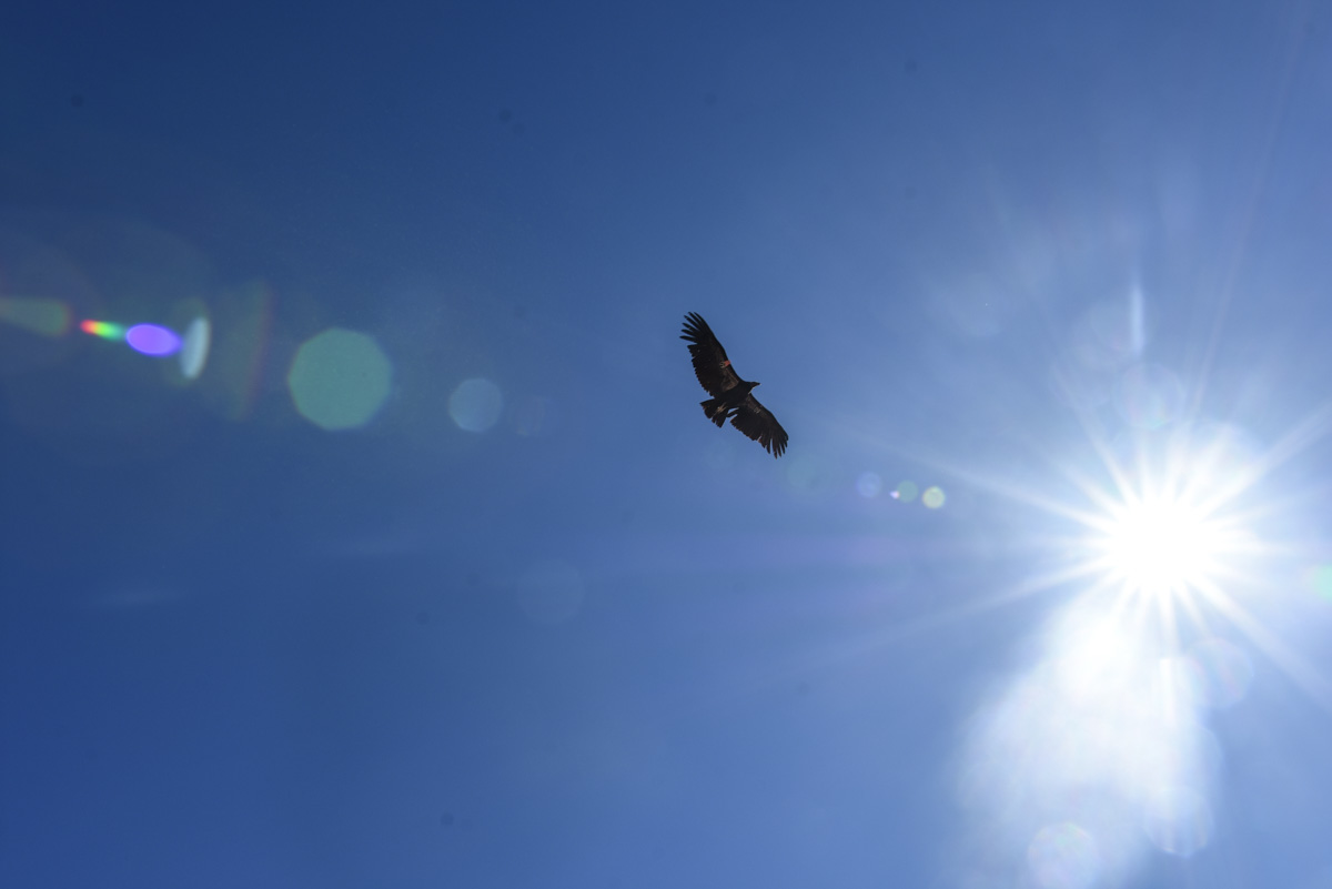
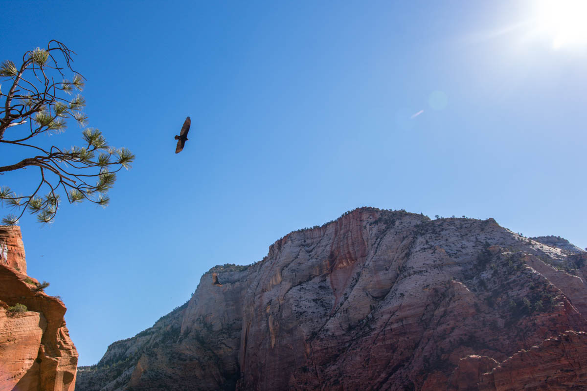
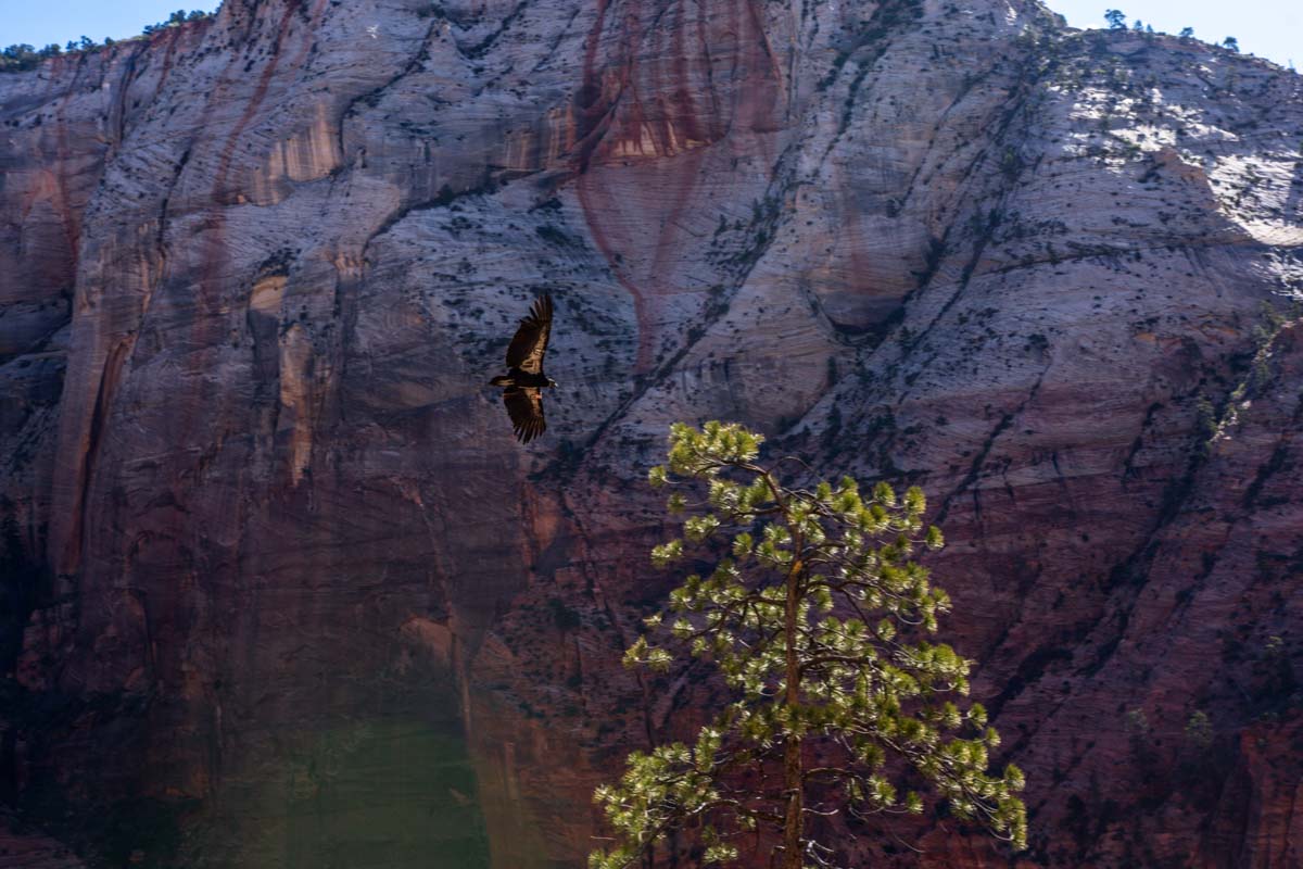
As we did so a large California Condor began circling overhead. At least, that’s when we noticed it, I imagine it spends its days, wings wide, catching air currents. It wasn’t long until we noticed another, then another. In total, I think I counted at least 8. It was a real thing of beauty, fitting for the setting and I could have watched them all day. In fact we probably did watch the majestic birds for about half an hour. Since we were already so high above the ground, they actually got quite close. Some of my photos captured surprising detail.
Lunch at the Zion Lodge
We headed back down to the valley and the shadow had yielded almost completely to the light of the late morning sun. We took the shuttle bus one stop to the lodge. The Lodge is the only place to buy food in the park that I saw and it is a convenient stopping place to rest up with a feed and a beer. The beer was from Moab, from which we had recently driven so it was nice to drink something local. Although they have some weird alcohol laws, Utah businesses do love to support their local homegrown breweries.
There is a large green space perfect for a picnic, or if your kids manage to still have energy there’s plenty of space to run around. As the name suggests, the lodge also has accommodation and is the only non-camping place to stay inside the National Park. It books out well in advance but I have heard that if you check a couple of days prior they have a lot of late cancellations. So try your luck.
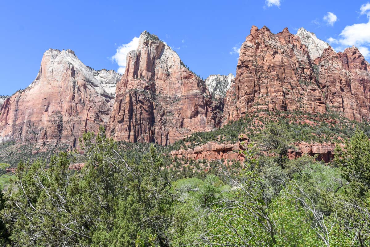
Court of the Patriarchs and Canyon Junction
I was gaining momentum and I had a few little stops I wanted to make on the way back towards the town. First up was stop 4, at which there is a 50 metre walk up a small embankment that looks across the canyon to three gargantuan rock formations named the Court of Patriarchs. Like many names in Utah — and not surprising given the influence and history of Mormons in the state — the Court of the Patriarchs is biblical.
The three structures are named for the three Patriarchs of the Bible; Abraham, Isaac and Jacob. It’s short enough that once you get off the shuttle, by the time the next shuttle comes, you’ll have seen enough.
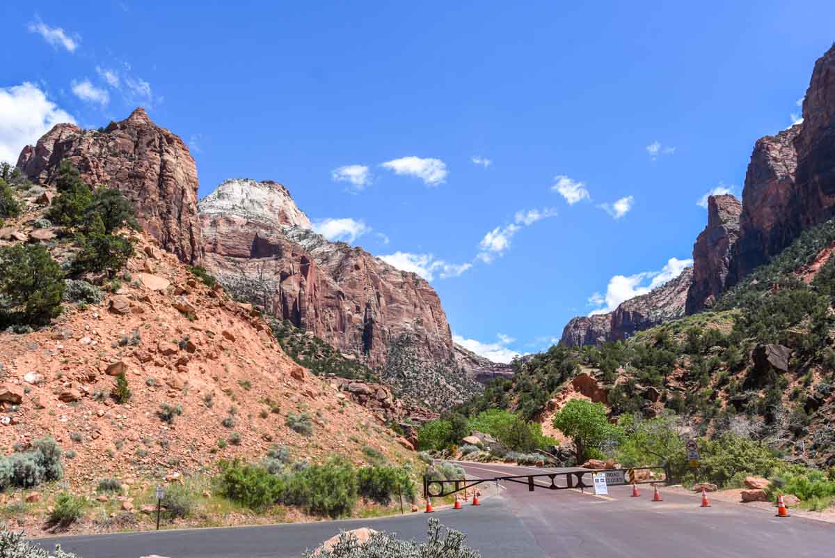
It’s a similar story at Canyon Junction. It doesn’t require long, in fact, I stopped more for curiosity sake because I wanted to see the ravine where the Carmel Scenic Highway ends. Since I couldn’t actually drive the road I figured I’d see what I could. I walked over to the gate that signalled its closure took a few photos and hopped back on the next shuttle.
Watchman’s Trail
My last stop on the tour of Zion NP was the Watchman’s Trail, which actually begins at the visitor centre. The moderate trail snakes up the east side of the canyon and eventually ends at a lookout with a perfect, unobstructed view looking up the canyon and back towards the beginning of Springdale.
I mentioned earlier that a lot of the strenuous hikes were closed, I felt that the Watchman’s trail was a perfect middle ground in difficulty between a few hundred metres and hiking up to the rim. It took a couple of hours, but it wasn’t continually uphill because it did wind around the hill for much of that distance.
After this I was pretty spent. I exited the park on foot and walked back to the RV park, which was at Springdale Shuttle stop number 3, less than a 10 minute walk from the visitor centre, and wrapped up the day with a well-earned beer.
Let’s keep in touch
Sign up for the mailing list below for the chance to become best friends.

this blog so nice
Great photos Luke. Those Condors, just beautiful. Makes me want to head back. xx